SERIConsulting Engineers Let’s talk

Consulting Engineers · Ongwediva, Namibia

Civil engineering.
Digital capability.

Civil infrastructure, project management and reality capture, supported by software and digital asset intelligence.

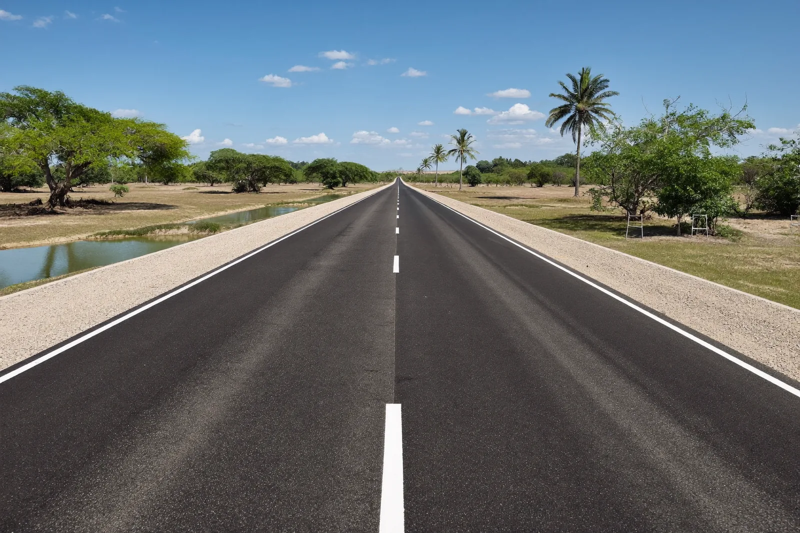
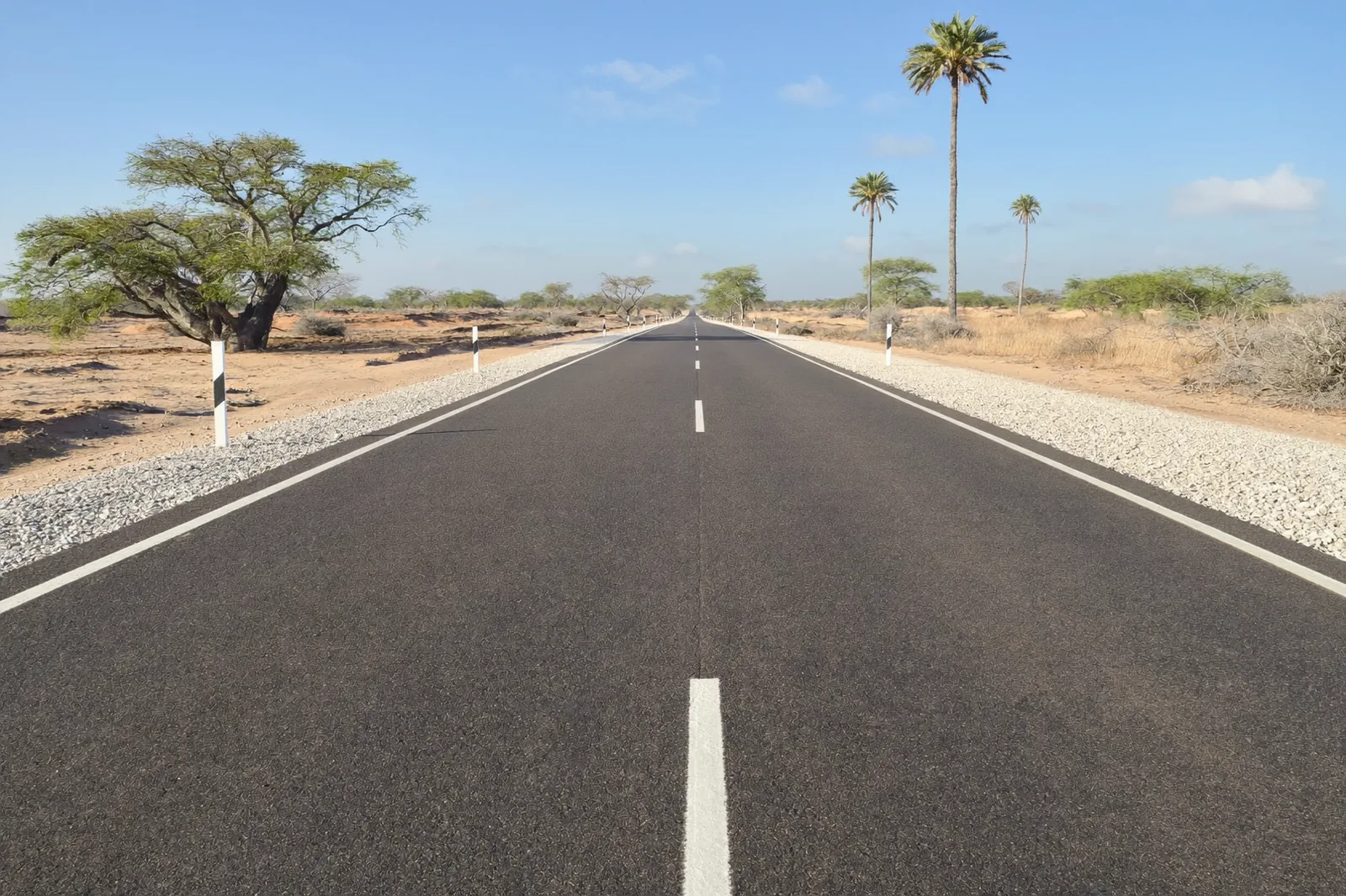
Completed low volume sealed road at DR3633 Tsandi–Ongulumbashe, with gravel shoulders and Namibian vegetation.
DR3633 · Tsandi–Ongulumbashe8 km gravel-to-seal upgrade
Stanley Gariseb, Project Manager · 2024–2025

Professional engineering practice

Civil infrastructure Digital systems Project management

01 / 06

Reality Capture

We specify, audit, process and model reality-capture data: UAV orthophotos, point clouds, terrain models and the control that anchors them. Capture is flown by NCAA-approved RPAS operators to Seri's specification.

  1. 1SpecifyGround control, GSD, overlap, datum and deliverable formats written before a flight is booked.
  2. 2CaptureFlown by the licensed operator against the specification.
  3. 3AuditEvery deliverable scored against independent control before it is trusted.
  4. 4ModelGeoreferenced twins with provenance on every feature.

Track record

Review of a delivered UAV survey: 3,056 RTK-tagged frames over 13 flights; 28.5 mm GSD orthophoto and a 2.46-million-point cloud checked against ground benchmarks; two georeferencing defects diagnosed and repaired.

Roads Authority, 2026

3,056
frames reviewed
28.5mm
ground sample distance
2.46M
points checked
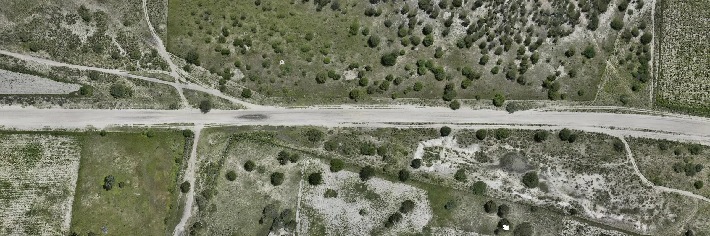
Orthophoto of a gravel road and verge in Namibian savanna, stitched from zoom-20 survey tiles at 0.142 m per pixel.

Orthophoto view. Select surveyed 3D to inspect the terrain.

Point cloud, Namibian road corridor · Roads Authority, 2026

Orthophoto colour on surveyed heights, 600 × 200 m of corridor. In 3D, drag or use the arrow keys to adjust the view.

02 / 06

Smart Infrastructure

Monitoring of water and structural assets on UltraPavement: sensor and telemetry specification, LoRaWAN field networks, and an operations workspace that turns readings into decisions.

Sensorslevel · pressure · flow · strain LoRaWANlow-power radio Gatewaysbackhaul to the platform PlatformUltraPavement Decisionsoperations · maintenance

Track record

UltraPavement carries the monitoring stack: live bridge and structural-health monitoring, water operations across pressure, flow, storage and device health, and an event desk ranked by priority. For the Divundu Scheme Extension the monitoring design was set out as value-engineering proposal VE-001: 48 monitoring points, 21 LoRaWAN nodes, 3 gateways, three service levels.

Luka Roads Rails and Civils CC · NamWater contract W/RB/NW-005/2025 · 2026

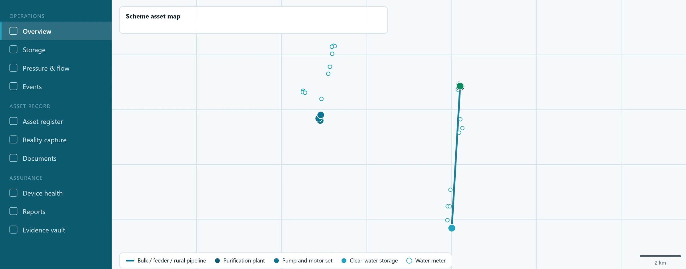
Water Operations workspace: the sidebar navigation and the scheme asset map with its pipeline, plant and storage legend.
UltraPavement Water Operations workspace · Divundu scheme design
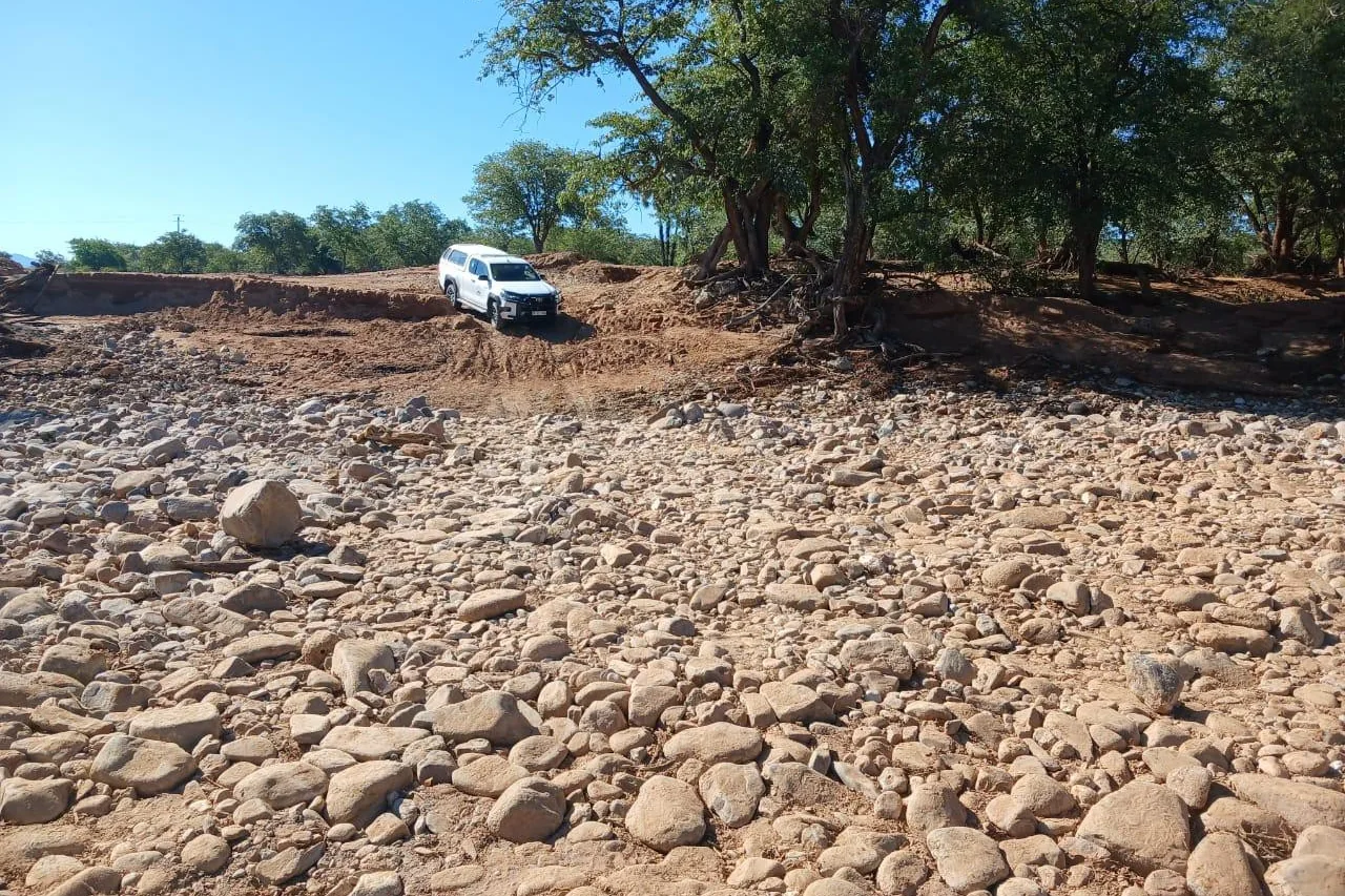
Watercourse crossing on District Road D3703 after flood damage.
D3703, Oshakati Region · flood-damaged watercourse crossing, 2026

03 / 06

Civil Engineering & Project Management

Roads, earthworks, drainage structures, tailings embankments and bulk water infrastructure, designed and delivered under COLTO, FIDIC and GCC.

TRH 17TRH 4SAPEMSARTSMCOLTOFIDICGCC

Capability

Roads and earthworks. Geometric design to TRH 17, pavement and layerworks to TRH 4, regravelling, low volume seal upgrading, cut-and-fill and materials utilisation.

Drainage and hydraulic structures. Catchment hydrology, hydraulic sizing of culverts, drifts, side drains and lined channels; gabion and stone-pitched protection; flood-damage reinstatement.

Tailings and water infrastructure. Staged embankment raises, buttresses, slope stability and seepage assessment, instrumentation monitoring; bulk pipelines, elevated reservoirs and pump stations.

Project and contract management. Tender documents and bills of quantities, tender evaluation, programme and cash-flow control, payment certification, variations, extensions of time and claims, site supervision.

Business Development. Proposal and bid development; value engineering; bid compliance review against the Public Procurement Act 15 of 2015 and its Regulations.
Infrastructure in the field

Experience, in context.

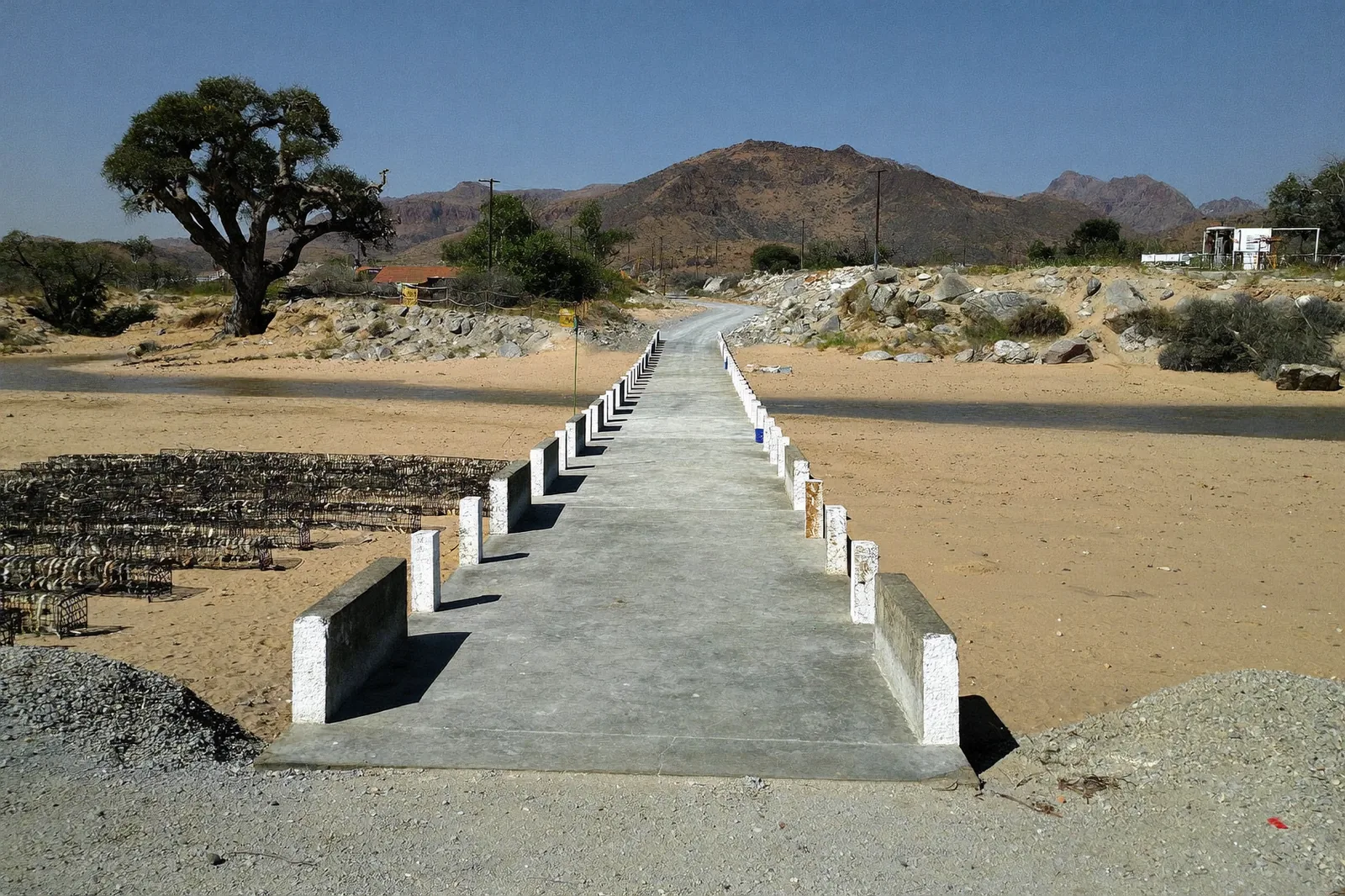
Concrete low-level causeway with white marker posts crossing a dry sandy riverbed in Kunene Region.
Low-level concrete causeway across an ephemeral river · Kunene Region
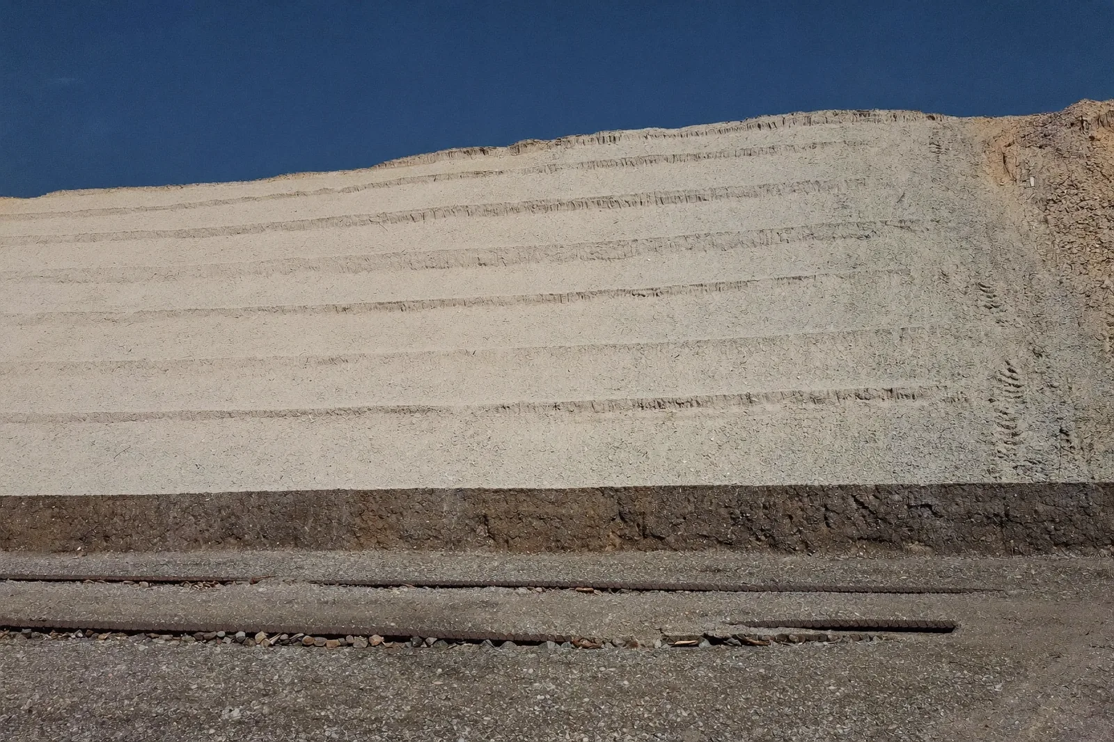
Tailings dam wall rising in benched lifts with a rockfill buttress berm and toe track.
Tailings Storage Facility, Rössing Uranium · benched embankment lifts and rockfill buttress · Delila Kalangula, 2015–2017
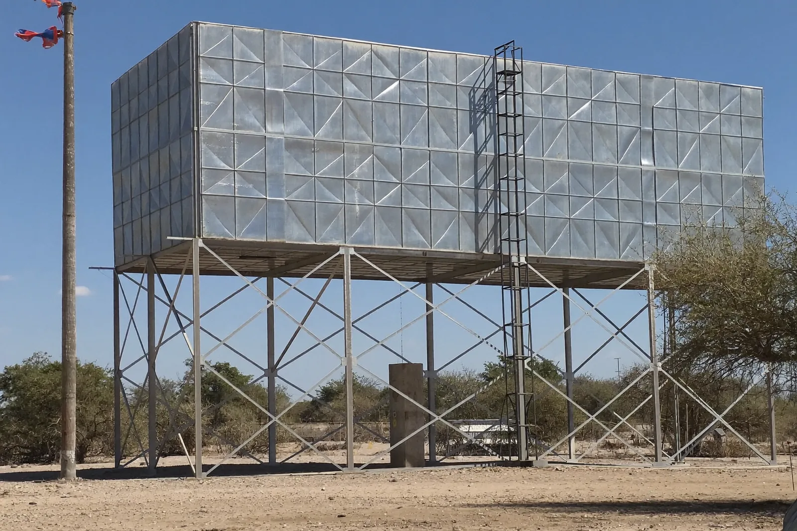
Rectangular pressed-steel panel water tank on a braced steel tower with a caged ladder.
Divundu Scheme Extension · elevated pressed-steel reservoir · Stanley Gariseb, Project / Contract Manager, 2026–2027
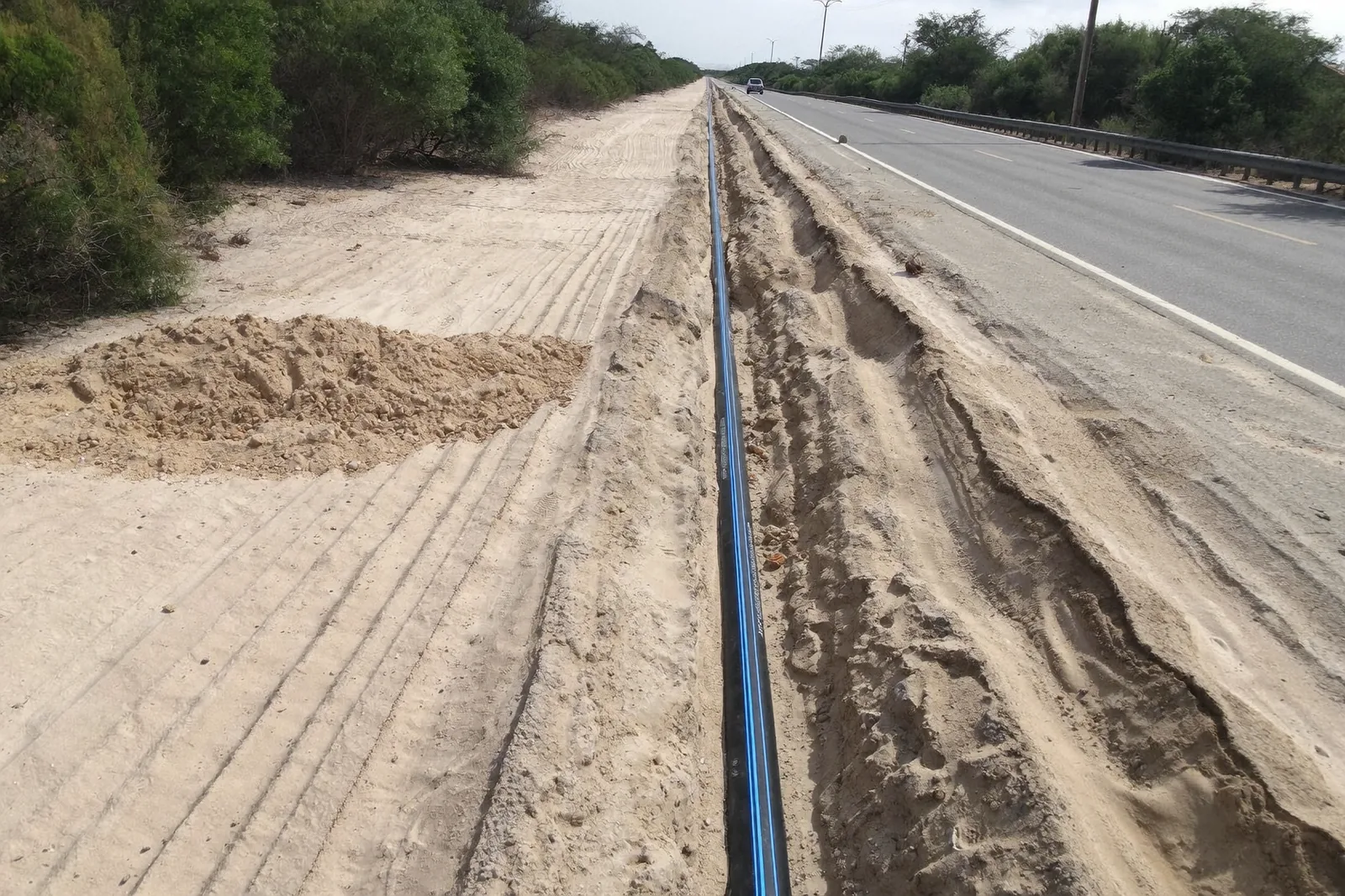
HDPE water main laid in an open trench in Kalahari sand beside a tarred road.
Divundu Scheme Extension · 10 km HDPE water main for NamWater, 2026–2027
Newly sealed two-lane district road with white edge and centre lines, gravel shoulders, delineator posts and makalani palms.
DR3633 Tsandi–Ongulumbashe · 8 km upgraded from gravel to low volume seal · Stanley Gariseb, Project Manager, 2024–2025
Newly sealed district road running straight past an oshana, with white road markings and gravel shoulders.
DR3671 Omatando–Onamutai · 10 km upgraded from gravel to low volume seal · Stanley Gariseb, Project Manager, 2021–2022
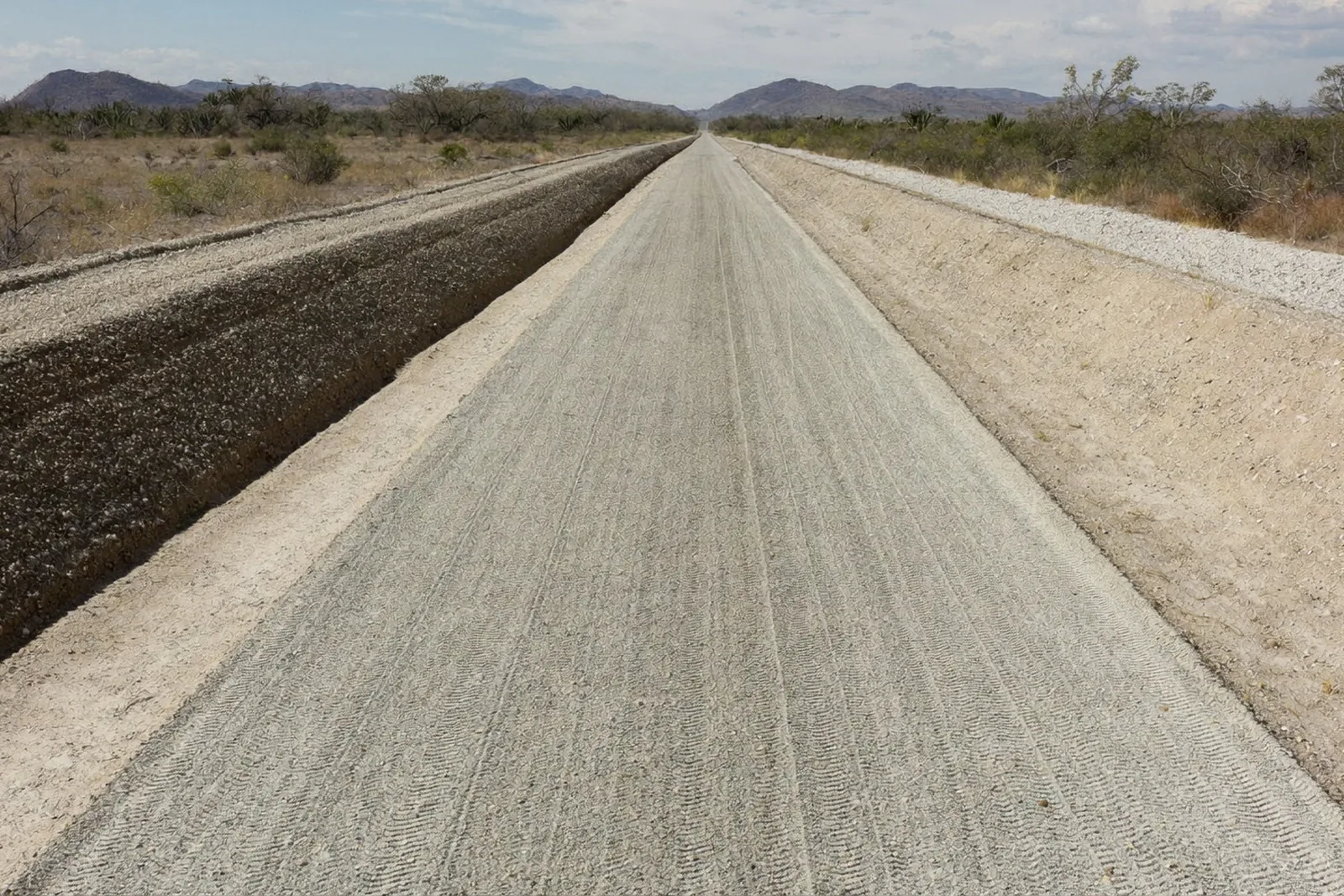
Freshly bladed gravel district road with a windrow along one edge and shaped side drains.
Opuwo Area gravel roads · some 30,000 blade kilometres a year under a five-year maintenance contract · Stanley Gariseb, Project Manager, 2024–2028

04 / 06

Software Engineering & Digital Transformation

Seri engineers on UltraPavement, the digital-twin platform developed and operated by its Technical Director. It is a Windows desktop application and web platform with native Rust and C++ engines for terrain, tiles and geometry, shipped through ninety-plus patch releases on a controlled release pipeline.

  • PlatformCesium 3D twins; IFC, DWG, DXF, LandXML, COPC, LAZ, GeoTIFF and ECW ingestion; OpenDroneMap photogrammetry; Supabase and Cloudflare storage; a PM Suite for programmes, certificates, quality and evidence with SharePoint integration.
  • twinkitThe working method Seri applies to external twins: a provenance ledger for every input, a CRS round-trip check, and coverage recorded as a first-class result. First applied to the Divundu terrain twin (2026).
  • Audit enginesTRH 17 geometric design audit; SAMDM / TRH 4 mechanistic-empirical pavement design; SANS 10160, SANS 10100 and SANS 10162 structural checks — applied in software design checks.
  • DataNational GIS with 412 Namibian reference layers and a road index of 150,858 records across Namibia and South Africa; MERIT-Hydro watershed routing for corridor drainage.

05 / 06

Founders' experience

In prior and current roles.

Scroll horizontally to see roles, years and scope

ProjectEmployer / clientFounder · roleYearsScope
UAV corridor survey review, DR3673Roads Authority (employer)Stanley Gariseb · Engineering Manager2026Review of a delivered UAV survey: 3,056 RTK-tagged frames over 13 flights; 28.5 mm GSD orthophoto and a 2.46-million-point cloud checked against ground benchmarks; two georeferencing defects diagnosed and repaired.
C43 / MR124 Opuwo–Sesfontein emergency worksRoads Authority (employer)Stanley Gariseb · Engineering Manager, Project Control Engineer2026Survey-control audit and datum control for a 2 km stabilised gravel platform with ten cross-drainage crossings; design-development package.
Divundu Scheme Extension (NamWater contract W/RB/NW-005/2025)Luka Roads Rails and Civils CC (client, as Contractor)Stanley Gariseb · technology and managed-service provider through UltraPavement2026IIoT water-service monitoring design, value-engineering proposal VE-001: 48 monitoring points, 21 LoRaWAN nodes, 3 gateways, three service levels. External digital twin built from the scheme's UAV contour survey.
DR3635 Amwaanda–Omutambo-OmaoweRoads Authority (client) through Aurecon Namibia (employer)Delila Kalangula · design engineer and assistant resident engineer within the Aurecon team2013–2015100 km road: design, contract administration and construction supervision.
Tailings Storage Facility operations and expansionRössing Uranium (employer)Delila Kalangula · Civil / Project Engineer2015–2017Design, monitoring and earthworks; seepage upgrade; heap-leach lined earthworks; geotechnical and instrumentation monitoring.
National road maintenance programmeRoads Authority (employer)Delila Kalangula · Roads Maintenance Engineer; Principal Engineer: Roads Maintenance2018–presentPlanning, design and implementation of maintenance and rehabilitation; drainage and flood-damage works.

06 / 06

People

Delila Kalangula, portrait

Delila Kalangula

Managing Director · Civil Engineer

Pr. Eng. PE2016-38 · EMBA · BSc Eng (Hons) · PGCert

Fifteen years across roads, mining and the public sector: Aurecon Namibia, Rössing Uranium and the Roads Authority, where she is Principal Engineer: Roads Maintenance. Engineering work at Seri is issued under her professional responsibility as the firm's registered Professional Engineer.

Governance
Non-executive board member, TransNamib Holdings Limited (2026–); board member, Roads Contractor Company (2018–2021).

LinkedIn
Stanley Gariseb, portrait

Stanley Gariseb

Technical Director · Software Engineer · Civil Engineer

MSc · EMBA · BSc (Hons) · PMP · IEng

Civil engineer, project manager and engineering manager: Roads Authority since 2016 and Engineering Manager since 2017, after Burmeister & Partners and Fischer Seelenbinder Associates. Lead architect of UltraPavement, the digital-twin platform Seri engineers on.

LinkedIn

Contact

Start a conversation.

Say what needs measuring, designing or monitoring. Every enquiry is answered with a scope and a method.

Office3675 Anton Lubowski Street
Ongwediva, Namibia

Delila Kalanguladelila@oracleprojects.com.na
+264 81 618 2630

Stanley Garisebstanley@oracleprojects.com.na
+264 81 160 0159